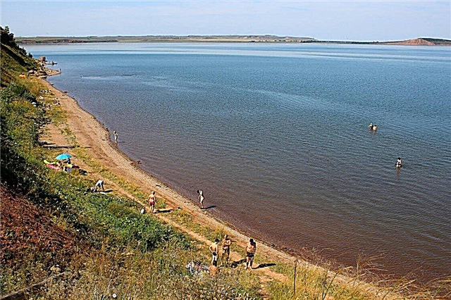
Bashkortostan's water resources are a national treasure. The lack of access to the sea on the territory of the republic is more than compensated by the presence of more than 2 thousand lakes. Most of them are located in the western part of the Ural foothills. In terms of their visual expressiveness, they are not inferior to the popular lakes of Switzerland and the Alps. All reservoirs have different origins: floodplain, karst, tectonic.
The water in them differs in salt composition, in some places it even has healing properties. Many lakes have the status of natural monuments. Rest on the Bashkir lakes is attractive for its beautiful landscapes, comfortable climate, peace and tranquility, low prices for tourist services. And for lovers of fishing, there is just expanse here. The ichthyofauna of local water bodies has about 40 species of fish, 13 of which are listed in the Red Book.
The most beautiful lakes in Bashkiria
List with names, photos and descriptions of water bodies popular for recreation!
Bannoe
A natural monument on the territory of the Abzelilovsky district, 45 km from Magnitogorsk. The origin is tectonic. Square - 7.7 km2, the maximum depth is 28 meters. This is the deepest lake in Bashkiria. It is also called Yatktykul - "bright lake". It is surrounded by mountains on all sides, the surroundings are rich in medicinal and rare plants. The water is clean, the ichthyofauna is diverse. There are many hotels, sanatoriums, rest homes, the active entertainment industry is well developed.

Aslykul
It is located 30 km from Davlekanovo, between the spurs of the Belebey Upland, on the territory of the natural park of the same name. Square - 23.5 km2, the maximum depth is 8 meters. This is the largest lake in Bashkiria. The origin is karst-sinkhole. The water is incredibly clean, bitter-salty. A lot of fish, different birds nest, even pelicans. There are plants and animals in the Red Book. Rest with tents or at the Aslykul base is available. The nearest villages are Kupoyarovo, Yangi-Turmush.

Karabalykty
"Black fish" is the translation of the name of this reservoir. This is what the Bashkirs call tench. The lake is located in the Abzelilovsky district, near the village of Tashbulatovo, in the vicinity of the lakes Sabakty and Bannoe. Square - 2.6 km2, the maximum depth is 6 meters. There are a lot of fish in the lake, but pike fishing is strictly prohibited. A nesting place for waterfowl. The banks are steep and consist of pebbles, stones and large cobblestones. It was here that the traces of the first man were found in the territory of the South Urals.
Hotels on Booking.com: Bungalow Afrika

Sabakts
It is located on the territory of the Abzelilovsky district, near the Kryktytau ridge. It is of tectonic origin and occupies a bowl-shaped basin. Square - 2.16 km2, the maximum depth is 6 meters. Warms up well in the warm season. The water is of poor transparency, there are a lot of algae at the bottom. The shores are covered with meadow vegetation and mixed woodlands. It is part of the famous jasper belt of the Trans-Urals. The nearest settlements are Kusimovsky Mine and Geological Prospecting.

Kandrykul
A natural monument, part of the natural park of the same name. It is located in the Tuymazinsky district, 25 km from the district center. The second largest in the republic. Area - 15.6 km2, the deepest is 17 meters. The water is perfectly clean and clear. There are many fish, crayfish, locals and birds resting on the way. The surrounding area is rich in flora and fauna. On the coast there are about 70 recreation centers and campgrounds. The ski slope is open in winter.

Blue (Zyangyarkul)
It is located 40 km from Ufa, near the village of Novomusino, at the threshold of the Karlamanskaya cave. It resembles a small saucer in shape, has an area of 400 m2... A mesmerizing sky-blue tint to the lake is given by deposits of useful blue clay at its bottom. The water is incredibly clear, even in the hottest season it is very cold, not higher than + 6 ° С, it does not freeze in winter. At the bottom there are 4 underground springs, one of them leads into a karst cavity.

White
It is located in the Gafuri region, on the banks of the Belaya River. Square - 10 km2, the deepest is 11 meters. Together with the adjacent meadow and forest areas, it is part of a protected reserve. The second name of the lake is Akkul. The ichthyofauna is represented by 30 species of fish, beavers and muskrats, many species of waterfowl live here. At the bottom of the reservoir, keys are beating. Coastal villages - Antonovka, Sofyino, White Lake. There is a sanatorium with the same name.

Talkas
Mountain lake of volcanic origin. It is located in the Baymak region on the slope of the Irendyk ridge. Square - 4.8 km2, the deepest is 12 meters. On the coast there are volcanic rocks - porphyrites, of which a small island in the middle of the lake is composed. The reservoir is surrounded by forests and steppes, rich in fish. Camp sites and children's camps have been built on the shore. Industrial gold mining is taking place in the vicinity. The nearest villages are Isyanovo and Tubinsky.

Nugush reservoir
Created in the 60s on the Nugush River, in the Meleuzovsky region. Length - 25 km, width - 5 km, maximum depth - 30 meters. Located in a national park. The banks are covered with large tracts of coniferous and mixed forests. There is a lot of fish, there is a trout farm. Recreation centers, camps, sanatoriums are located along the reservoir. Many tourist routes pass through Nugush, including river rafting, bicycle and horse tours, boat excursions.
Hotels on Booking.com: Nugush

Kalkan
Translated from Bashkir, the name of the reservoir means "shield". It has a rounded shape and is divided into two parts by a 0.5 km long peninsula. Located on the territory of the Uchalinsky district, near the Kalkan-Tau mountain, surrounded by coniferous-larch forests. It is of tectonic origin. The surroundings are famous for the emergence to the surface of a special type of jasper - Kalkan jasper. A popular destination with tourists. Nearby are the villages of Kalkanovo and Rysaevo.

Aushkul
A compact oval-shaped lake on the territory of the Uchalinsky district, at the foot of Mount Aushtau. Square - 2.2 km2, the maximum depth is about 3 meters. Great for swimming and fishing. The surrounding area is rich in jasper deposits. On the mountain there are burials of the preachers of Islam revered by the Bashkirs. Another local attraction is the healing spring Aulia, which beats only in spring and then dries up. The nearest villages are Starobayramgulovo and Yalchigulovo.

Muldakkul
The second name of the lake is Salt. Located 15 km from Magnitogorsk. Square - 8 km2, the maximum depth is 2.5 meters. It is famous for its bitter-salty water and huge deposits of black mud. They are used for treatment in the popular health resort "Yaktykul" and other local sanatoriums. There are no fish and algae in the lake, the coastal flora is represented only by salt-loving plants. The nearest settlement is Ozernoe, 1 km from the reservoir.

Karagaikul (Vorozheich)
Natural monument. Located in the Uchalinsky district, 3 km from the district center. It has an almost regular rounded shape with a diameter of 2.5 km. The maximum depth is 6 meters. One of the most picturesque lakes in Bashkiria. It is surrounded on all sides by birch groves, hills, rare plant species. Jasper deposits come to the surface along the banks. Some parts of the reservoir are covered with water lilies and egg capsules, thickets of reeds and hornwort. A lot of fish, especially crucian carp.
Hotels on Booking.com: Uchaly

Uzunkul
The name translates as "long lake". It is 4.5 km long and 1.5 km wide. Lies in a mountain valley west of Tashyar peak, 26 km from Beloretsk. There are floating green islands on the lake - floaters. There are always a lot of fish near them. Popular recreation area. Ancient workshops for the processing of jasper were discovered in the vicinity, which are at least 10 thousand years old. There are two villages on the coast - Uzunkulovo and Ozernoye.

Urgun
Natural monument. Occupies a depression with an area of 12 km2, has a tectonic origin. It is located in the Trans-Urals, on the territory of the Uchalinsky District, surrounded by larch and pine plantations. The maximum depth is 8 meters. Rich ichthyofauna - roach, pike, crucian carp, rudd. A nature reserve has been organized in the vicinity to protect the rare spring adonis. The rest house "Urgun" was built on the shore. Nearby are the villages of Muldashevo and Uchaly.

Sarvinskoe
Natural monument. It is located on the territory of Nurimanov district, near the village of Sarva. Spring lake. The source of the river of the same name, which in some areas flows underground and flows into one of the tributaries of the Ufa. It is of karst origin. The length is 60 meters, the width does not exceed 30 meters, the maximum depth is 38 meters. The water is blue in color, very clean and transparent, but cold enough, not higher than + 5 ° C. A spring water bottling plant has been built in the village.

Shamsutdin
Natural monument. It is located in a beautiful place, in the middle of dense coniferous and mixed forests, 7 km from Birsk. Has an original S-shape. Square - 3.2 km2, the deepest is 12 meters. The name is associated with a local romantic legend about the unhappy love of a guy named Shamsutdin. The lake is rich in fish; there is a beach area on the coast for vacationers. There are several tourist centers and a popular holiday home of the same name along the reservoir.

Big Uchaly
It is located on the territory of the Uchalinsky district, between the town and village of the same name. Square - 3.5 km2, the maximum depth is 6 meters. The origin is tectonic. The bottom is rich in deposits of useful sapropel deposits. Ichthyofauna is diverse - pike perch, crucian carp, bream, catfish, carp. On both sides the lake is surrounded by low mountains - Shimandak, Kakbash, Karagayyube. The banks of the reservoir are covered with mixed and coniferous forests, where you can find a hare, marten, mink.

Chebarkul
It is located in the Abzelilovsky district, 15 km from Magnitogorsk, near the village of Davletovo. Square - 10 km2, the maximum depth is 3.5 meters. It is famous for its excellent fishing. There are several small islands on the lake where locals like to relax. In the 60s of the last century, the Yangel site of ancient people of the Mesolithic era was discovered on the coast. Marble, ornamental stones, limestone, magnesite, loose gold are mined in the vicinity.

Athavda
Natural monument. It is located in the Abzelilovsky district, 50 km from Magnitogorsk, near the village of Atavdy. Square - 8.3 km2... In the middle of the reservoir there is a small island with a birch grove, therefore another name for the lake is Ostrovnoye. The banks are covered with various herbaceous vegetation. There are many waterfowl. A popular recreation area among local residents who come here with tents, boats, barbecues.

Kultuban
It is located 6 km from the city of Sibay, on the territory of the Baymak region. The second name of the lake is Yaugul. It is of karst origin, occupies a rounded basin 3.5 km long and 2 km wide. The maximum depth is 5.5 meters. It is one of the reservoirs of important fishery importance. In the vicinity, gold, manganese, limestone, and jasper are mined. The village of Kultaban is located on the shore. There are many cozy places for wild recreation.

Kieshki
Natural monument. It is located in the vicinity of the village of Starye Kieshki, where the famous Sergei Aksakov spent his childhood. He described all the delights of the local reservoir in his works. The second name of the lake is Aksakovskoe. Its length is 3 km, width is no more than 100 meters. It is famous for its notable fishing. On all sides, the lake is surrounded by flooded meadows and forests rich in mushrooms and viburnum thickets. Nearby archaeologists have discovered an Iron Age burial ground.

Tugarsalgan
Natural monument. It is located 7 km from the city of Ishimbay, near the famous shihan Toratau. Square - 1 km2, while the maximum depth is 27 meters. There is a small island in the middle. Another name for the lake is Serpentine. Recently, it has been privately owned. Recreation areas are equipped for vacationers, you can go fishing or boating on the lake. There is a small fee for this.

Upkankul
Natural monument. It is located on the territory of the Nurimanov district, 2 km from the village of Nimislyarovo. Has an area of 0.3 km2 and arched shape. A popular place among tourists and fishermen, a dirt road leads directly to the coast from the village. The main value of the reservoir is two varieties of water walnut, Alatyr and Ural. The latter does not grow anywhere else in Bashkiria. To protect the plant, a forester's house was built on the lake, areas with walnuts are fenced.

Shingakkul
A natural monument as part of the state sanctuary of the same name. The name translates as "drying lake". It is located on the territory of the Chishminsky district, near the Shingakkul village. Square - 2.4 km2, the deepest is 6 meters. The lake is very swampy, only gold and silver crucians are found among fish. The surroundings of the reservoir serve as a haven for more than 60 species of waterfowl, including rare and in need of protection.


